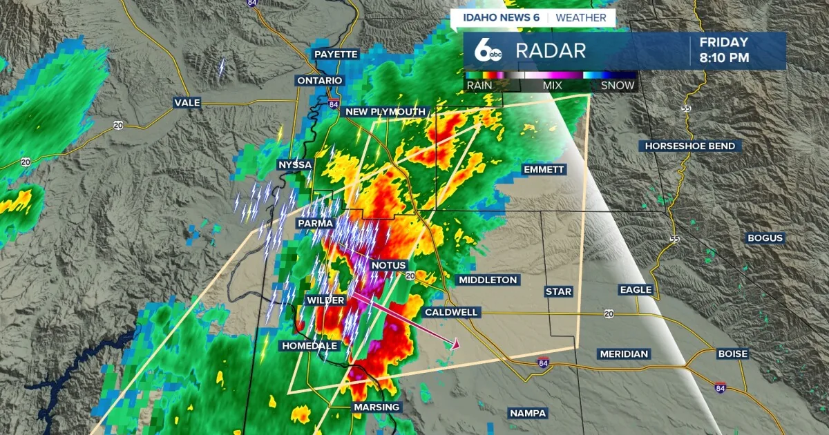
BOISE, ID — Thunderstorms are still expected to roll through Idaho overnight, although the severe wind threat is fading and the storms should become less intense. Heavy rain continues in some areas, and a few storms may still bring brief downpours and small hail.
The unsettled pattern is forecast to last through Saturday, with the best chance for stronger rain focused in southwest Idaho. Central Idaho mountains could see enough rainfall to raise the risk of rock slides and localized flooding, especially near old burn scars such as the Wapiti fire area.
Rain and mountain impacts
Forecast amounts call for 1 to 1.25 inches of precipitation across the central Idaho mountains through Sunday. Eastern Oregon may pick up 0.25 to 0.75 inches, while the Snake River Plain is expected to see roughly 0.25 to 0.50 inches.
Above 6,500 feet, forecasters say up to 3 inches of wet snow is possible from Saturday night into Sunday. That mix of rain and mountain snow could make travel and backcountry conditions more difficult in the higher terrain.
Weekend turns much colder
Temperatures are expected to drop sharply, with readings running about 20 degrees below normal on Saturday and Sunday. Several places could come close to record low maximum temperatures, and southeast Oregon may see near-record low temperatures Sunday morning.
The cold air should keep the region feeling more like early spring than mid-July. That pattern is expected to linger through the weekend before a slow rebound begins early next week.
Forecast eases Sunday
Showers and storms should begin to taper off early Sunday as the weather system moves away. Some showers may linger in the northern mountains into Monday and Tuesday, but the overall trend turns warmer and drier.
Another cold upper-level low is expected to approach from the British Columbia coast on Wednesday, though forecasters say confidence is low because models disagree on its track and strength.
Day-by-day outlook
Tonight brings showers and possibly a thunderstorm, with a low around 52 and a 90% chance of precipitation. Saturday stays unsettled with showers and possible thunderstorms before and after noon, then a slight chance of showers Saturday night.
Sunday stays partly sunny with a 30% chance of showers, followed by a warming trend Monday through Friday. Highs are forecast to rise from the 60s and 70s early in the week into the mid-80s by Thursday and Friday.
SpeedReadNews tracks Montana and the surrounding frontier, fast and factual.